Skip to content
🌍 Visualisation
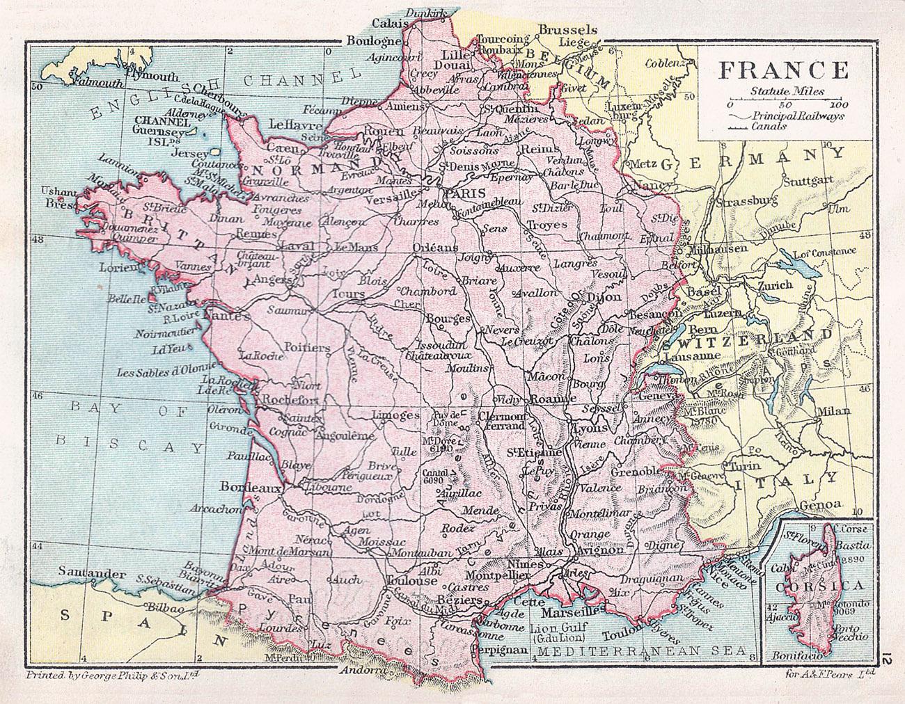
Antique map of France from sometime in the late 1800’s to early 1900’s
←
A new map of the valleys hidden beneath Greenland’s ice sheet (bed elevation)
Births minus deaths per 1,000 residents, EU and its neighbours, 2025
→
More posts
People who drink alcohol at least once a week, EU and neighbours, 2019
October 22, 2026
Percentage of people at risk of poverty in the European Union
October 18, 2026
Two types of mycorrhizal fungi in Europe
October 14, 2026
How little daylight Europe gets at the Winter Solstice
October 12, 2026